2025/08/29
Katla Volcano: The sleeping giant of Iceland
Katla, one of Iceland's most formidable and recognizable volcanoes, looms beneath the Mýrdalsjökull glacier in southern Iceland. Its name evokes awe, as Katla’s eruptions have historically sometimes been cataclysmic, reshaping landscapes and lives. In this article, we explore Katla’s geological characteristics, its storied history, the notorious 1918 eruption, and the risks it poses today.
Key geological and geographical highlights of Katla volcano include:
*Remember, a glossary of geology terms sits here.
Type: Subglacial stratovolcano, tuya morphology.
Caldera: Measures approximately 10 kilometers (6+ miles) in diameter, covered by a thick ice cap.
Activity: Erupted at least 20 times since Iceland’s settlement in the ninth century
Eruption Style: Predominantly explosive eruptions, but occasional large-scale, fissure-style effusive eruptions, both of which can produce massive jökulhlaups (glacial outburst floods) as heat from eruptions melts the overlying ice.
Tephra Deposits: Katla’s basaltic and rare silicate tephra layers are widely dispersed, with some reaching as far as mainland Europe.
Location: Under Mýrdalsjökull glacier, about 20 km due north of Vík and 180 km southeast of Reykjavík.

Map of earthquakes recorded at Katla volcano in 2025, monitored by the Icelandic Meteorological Office, showing seismic activity beneath Mýrdalsjökull glacier.
Katla, the more active, big sister to the globally infamous Eyjafjallajökull, is perhaps mischaracterized as being dormant. While this volcano has not explosively erupted in modern times (i.e., recent decades), it is far more historically active and havoc-wreaking than its air traffic-stopping neighbor, Eyjafjallajökull. In fact, given its position under a thick glacier, it is quite possible that many smaller eruptions have occurred with limited detection, including three such possible events since 1950. In the absence of modern measurements and constant observation, historical records primarily chart the volcano’s explosive history only. But Katla has a dramatic, deep history for hundreds of thousands of years.
Before Time: Prehistoric Eruptions
Born over 800,000 years ago, most of Katla’s eruptive history, as captured in Iceland’s rock record, was eroded away during the last glacial Ice Age, approximately 10,000 years ago. Even in the absence of written record, scientists can track eruptive past through the mapping of ash and tephra layers throughout Iceland and in neighboring continents. Katla’s prehistoric activity is marked by large eruptions, some of which significantly influenced global climates:
~6,600 BC: Evidence from sediment cores indicates a major eruption, with ash deposits found across the North Atlantic region.
~2,900 BC: A large eruption left substantial tephra deposits in Greenland ice cores, suggesting widespread impact.
~1,500 BC: Katla’s activity during this period is associated with severe climatic cooling, as recorded in European tree rings and Arctic ice.
These ancient eruptions underscore Katla’s potential for widespread impact in Iceland and beyond. If you are interested in what the south Iceland region could look like directly after a large-scale, tephra-rich eruption, the series Katla on Netflix shows the town of Vík and the surrounding dried river flood plains blanketed in meters of ash and sand.
Beyond this, the effusive eruptions associated with Katla should not be understated. Three massive fissure eruptions have been noted in the rock record at Katla, the last being right after Iceland’s settlement in the year 939 with the onset of the Eldgjá eruption. These are like the eruptions at Fagradalsfjall and Sundhnúkur on the Reykjanes peninsula, but with an exponentially larger length and output. This eruption, called Eldgjá along with the canyon the lavas now inhabit, created the longest series of fissures ever recorded in Iceland at almost 80 km (50 miles) in length, and was the largest effusive eruption of the last millennia in terms of erupted lava volume. The area of lava that was deposited from these fissures during the almost year-long eruption would be equal to the entire metropolitan capital area of Reykjavík and its suburbs. This eruption also has associated tephra found in Greenland due to an initial preatomagmatic (i.e., ice-magma interaction) explosion, and ejected gases and aerosols into the atmosphere that impacted global climate for years.

Katla’s powerful 1918 eruption sent a towering ash cloud into the sky, marking one of Iceland’s most significant volcanic events of the 20th century.
Katla eruptions in the modern historical record
Since the settlement of Iceland in the ninth century, Katla has produced over 20 notable explosive eruptions, including Eldgjá mentioned above. Four of those eruptions were rated VEI-5; one of those eruptions notably resulted in two deaths from lightning that formed from the resulting towering ash cloud. The 1918 eruption of Katla is one of its most infamous events, still fresh in the cultural consciousness, remembered for its power and consequences. Given that first-hand accounts of this eruption indicate people in Vík were anxious that preceding seismic events were signs that Katla was waking up indicates that this volcano has been in the cultural historical memory for centuries.
Timeline: began on October 12, 1918, lasting approximately 24 days.
Precursors: felt and perceived seismicity around Vík a few hours before the eruption
Explosivity: classified as a VEI-4 event; one of the largest eruptions in Iceland’s 20th century.
Glacial outburst - Jökulhlaup: catastrophic glacial flooding, releasing an estimated 8 km³ (2 mi³) of meltwater; carried massive icebergs and sediment, reshaping the Mýrdalssandur plains and extending Iceland’s coastline by up to 5 kilometers in some areas.
Tephra and Ashfall: ash clouds darkened the skies with frequent lightning, with deposits recorded throughout Iceland and as far away as mainland Europe; fallout severely impacted agriculture by contaminating water sources and blanketing farmlands.
Environmental Impact: significant sulfur dioxide released, contributing to regional climatic anomalies.
Human Impact: no fatalities were directly attributed to the eruption, though destruction of farmlands and infrastructure caused hardships for local communities.

Icebergs left behind after the devastating glacial outburst flood (jökulhlaup) that followed Katla’s 1918 eruption. For scale, notice the man on the right.
Flooding did not just end with the initial eruption, but continued in punctuated pulses throughout the almost month-long event. Icebergs that were deposited onto the flood plains by floods were so large they stayed there for months, and an ice canyon 1700 m long x 500 m wide x 130 m deep was carved into the glacier from the initial flood outburst. The fast-moving, widespread nature of these floods means they are sometimes the most dangerous, life-threatening part of these large, explosive eruptions.
Regarding the eruption itself, tephra fall, primarily ash, was noted as falling somewhere within Iceland daily during the eruption. Later mapping revealed that an area of 20,000 m2 received a tephra layer of 0.5 cm or greater (for comparison, the capital metropolitan area in Iceland is just under 800 m2). Like the flooding, tephra fall also came in perceptible pulses, with the longest lasting thirteen straight hours and depositing 3-4 cm of ash nearby.
Extra Saga: Katla’s link to Lava Show
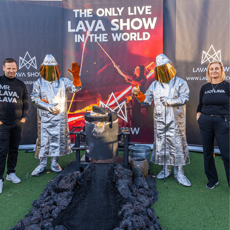
The story of Katla is told in the Lava Show showroom in the town of Vík. In 1918, the great-grandfather of our co-founder, Júlíus (the original Mr. Lava Lava), was a part of a group of men herding sheep on horseback on Mýrdalssandur (glacial flood plain). They first heard a low rumbling and the loud booming sounds. When they saw a wall of water coming towards them at speed, some 2-3 meters high, they were forced to gallop to the nearest hill, barely escaping with their lives. Unfortunately, their livestock did not survive. Other first-hand accounts discuss how house-sized icebergs were deposited in people’s yards at their farms, and how the nights were fully blacked out, save for frequent lighting, as so much tephra and ash was falling. The 1918 eruption serves as a stark reminder of Katla’s destructive potential, particularly its ability to unleash sudden, large-scale floods and widespread ash fall.
Modern Eruption Evidence and the Next Big Eruption
Since the 1918 eruption, there have been no explosive, above-ice eruptions at Katla. However, there have been multiple unconfirmed, subglacial events associated with evidence that a heat-producing episode had occurred. In 2011, more than a year after the eruption of Eyjafjallajökull, geophysical signals consistent with subsurface magma movement were measured, followed by a destructive jökulhlaup. This outburst flood destroyed a bridge along the Ring Road during high tourist season, leaving travelersand entire towns stranded and cut-off from resources.
In the months leading up to the event, inflation (ground rise) was recorded at GPS stations across the glacier that covers Katla. Weeks before the flood, a harmonic tremor was recorded. This low-frequency, longer-duration acoustic signal is a primary, tell-tale sign of magma ascending. This was followed by a very shallow earthquake swarm. These key indicators, combined with the glacial outburst flood, lead geologists to believe a minor eruption or hydrothermal/geothermal event took place. Without tangible evidence of an eruption (lava, ejecta, tephra, ash cloud), these events' origins remain unclear.
This leads scientists and locals to ponder when the next big Katla eruption will occur, and if there will be warning signs. Anecdotally, the hypothesis that Katla always erupts after Eyjafjallajökull seems to be a case of “correlation is not necessarily causation.” With only four Eyjafjallajökull eruption data points since written history began in Iceland, at least 16 Katla eruptions not linked to any other volcanic activity, and an unconfirmed Katla eruption subsequent to the large 2010 headline-making eruption, this trend cannot be confirmed. Additionally, summer “warmth” here in Iceland causes an uptick in shallow seismic activity related to shifting and melting ice, as well as smaller jökulhlaups, which can cloud underlying magmatic signals. For example, 390 earthquakes have occurred at Mýrdalsjökull since the beginning of this year, but 314 of those have occurred since May 1st.
With this in mind, it seems the clearest precursor signs to be:
Summit inflation (ground rise) - months to weeks ahead of eruption
Earthquake swarms - some months to weeks before, larger episodes hours before
Harmonic tremors - most likely weeks to days prior
Melting caldera ice - if seen, months to weeks in the lead-up
Sulfur smell or steam - if it occurs, just hours preceding
Given that Katla has not erupted since the advent of modern measurement and observation technology, there is no clear set of precursor data that exists yet. Scientists rely on analogs and anecdotal evidence to formulate hypotheses on what will happen at Katla in the lead-up to an eruption.
Of course, the question on everyone’s mind is when will Katla erupt next? This is, obviously, not easy to answer. Currently, there are no geophysical signs that indicate Katla is preparing to erupt, but eruption trends would indicate that sometime (geologically) soon a large eruption will occur. Looking at Katla statistics, the average time between eruptions is anywhere from 20-90 years, with a mean of 48 years. Thus, the 107 years between now and 1918 is 1.34 standard deviations above the mean, and explosive eruptions at Katla have a 92% probability of happening by now. There is, however, no telling if that next big eruption will be next month or in 50 years, and volcanoes erupt whenever they want.

Mýrdalsjökull glacier, under which the mighty Katla volcano lies dormant, shaping Iceland’s dramatic landscapes.
Katla’s Risk Today
So why worry about a Katla eruption? Katla’s dormancy since 1918 has heightened concerns about the potential for a large-scale eruption, given the time that has elapsed to accumulate magma. After seeing what happened with explosive eruptions at next-door Eyjafjallajökull in 2010 and regionally adjacent Grimsvötn in 2011, current risks can include:
Seismic Activity: Increased earthquake swarms under Mýrdalsjökull can cause earthquakes that dislodge ice before powerful flooding and can be felt regionally and at local tourist attractions along and atop the glacier.
Ice Melt and Flooding: An eruption could rapidly melt large volumes of glacial ice, producing catastrophic jökulhlaups that threaten nearby communities and infrastructure, including Route 1, Iceland’s main highway, and the village of Vík.
Air Travel Disruption: Ash plumes from a Katla eruption could impact transatlantic flight routes, as seen during the 2010 and 2011 eruptions.
Climate Impact: Katla’s potential to release sulfur dioxide could lead to short-term climatic cooling, with effects felt globally.
Preparedness & Resources: Iceland is incredibly prepared and trained for eruptive events, but since it is a small island nation, personnel and resources are finite and can put strain on rescue, government, and law enforcement organizations; the addition of travelers who are not as familiar with volcano safety and warning signs as locals adds an unpredictable element to evacuations and cordoning.
Volume of Lava and Tephra Generated by Katla
Katla’s eruptions are remarkable for the immense volumes of lava and tephra they produce:
Lava: While Katla’s eruptions are primarily explosive, some events have produced substantial lava flows. The 1918 eruption alone generated significant lava deposits that reshaped the local landscape.
Tephra: Katla’s tephra production is among the largest of Icelandic volcanoes. Estimates suggest some eruptions have released over 2 cubic kilometers (0.48 cubic miles) of tephra, with layers found across Europe and Greenland.
Jökulhlaup Sediment: The floods resulting from eruptions transport vast amounts of glacial sediment, further transforming the surrounding plains.
This prolific output underscores Katla’s power, contributing both to its local hazards and its far-reaching geological impact.
Comparisons to Well-Known Volcanoes Around the World
To understand the scope of Iceland's volcanics and Katla's place within that context, a look at global volcanic statistics to set the scene can help. Of the 203 VEI-4 or larger volcanic eruptions that happened around the world from 1600 onward, 31 of them happened outside of the Pacific Ring of Fire. Subduction settings like this dominate the global volcanic landscape, and on average, produce far larger and more numerous eruptions than other geologic settings. That said, of the 31 eruptions beyond the Pacific Rim, 22 of those happened in Iceland. Iceland´s volcanoes are the most prolific non-subduction* systems in the world. And of those 22, a staggering eight can be attributed to Katla.
*above the ocean
To further provide context, Katla’s activity can be compared to several famous volcanoes, highlighting its unique characteristics:
Vesuvius (Italy): Both Katla and Vesuvius are capable of producing explosive eruptions. The famous 79 AD eruption was a VEI-5, producing a deadly pyroclastic flow and scorching ash fall, and previous eruptions prehistoric are hypothesized at VEI-6. However, Katla’s jökulhlaups add a dimension of flooding not seen with Vesuvius.
St. Helens (USA): Katla’s eruptions rival Mount St. Helens in explosivity, with the 1980 eruption labeled at VEI-5, too. But, again, Katla’s subglacial setting increases the risk of massive floods.
Pinatubo (Philippines): the largest volcanic eruption of the last 100 years, this VEI-6 eruption lasted on and off for over a year, and, similar to the above-listed volcanoes, produced deadly pyroclastic flows. Katla produced smaller ash clouds, and eruptions are usually of shorter duration than Pinatubo.
Krakatoa (Indonesia): Known as the loudest explosion ever recorded by man, this VEI-6 eruption caused a five-year-long volcanic winter and destroyed entire islands. Both volcanoes can generate global climatic effects through ash and gas emissions, though Katla’s eruptions are often less frequent and usually not on the same scale.
Eyjafjallajökull (Iceland): Katla’s eruptions are typically larger and more destructive, with greater volumes of tephra and more extensive flooding. So everything experienced in 2010 could be much more widespread and effective with a Katla eruption.
Reykjanes (Iceland): These eruptions are almost all primarily fissure style eruptions, with only very small preatomagmatic explosions that happen with groundwater. Katla has occurrences of effusive fissure eruptions like those seen on Reykjanes, like at Fagradalsfjall and Sundhnúkur, but on a much larger, longer, and deadlier scale.
Katla’s unique combination of explosive power, gas emissions, glacial flooding, and widespread ashfall makes it one of the most hazardous volcanoes in Iceland, but also regionally and globally with atmospheric and climatic effects. While Katla is not “overdue” nor “sleeping” as discussed, as each year passes, Katla grows more primed to erupt again. A stop at the Lava Show in Reykjavík or Vík will help prepare you with information and awe about the possibilities that Katla possesses.
Resources cited:
Jökull - The 2011 unrest at Katla volcano: seismicity and geological context
Wikipedia - Largest eruptions of the 21st Century and 20th Century since 1500
Written by Jessica Poteet. Here is an interview with her in the Lava Academy podcast.