Volcanoes
Bárðarbunga: Iceland’s Powerhouse of Fire and Ice
Bárðarbunga is one of Iceland’s most powerful and active volcanoes. Hidden beneath the vast Vatnajökull glacier, this subglacial giant has shaped Iceland’s landscape for thousands of years, producing some of the country’s largest eruptions.
Geological Facts About Bárðarbunga
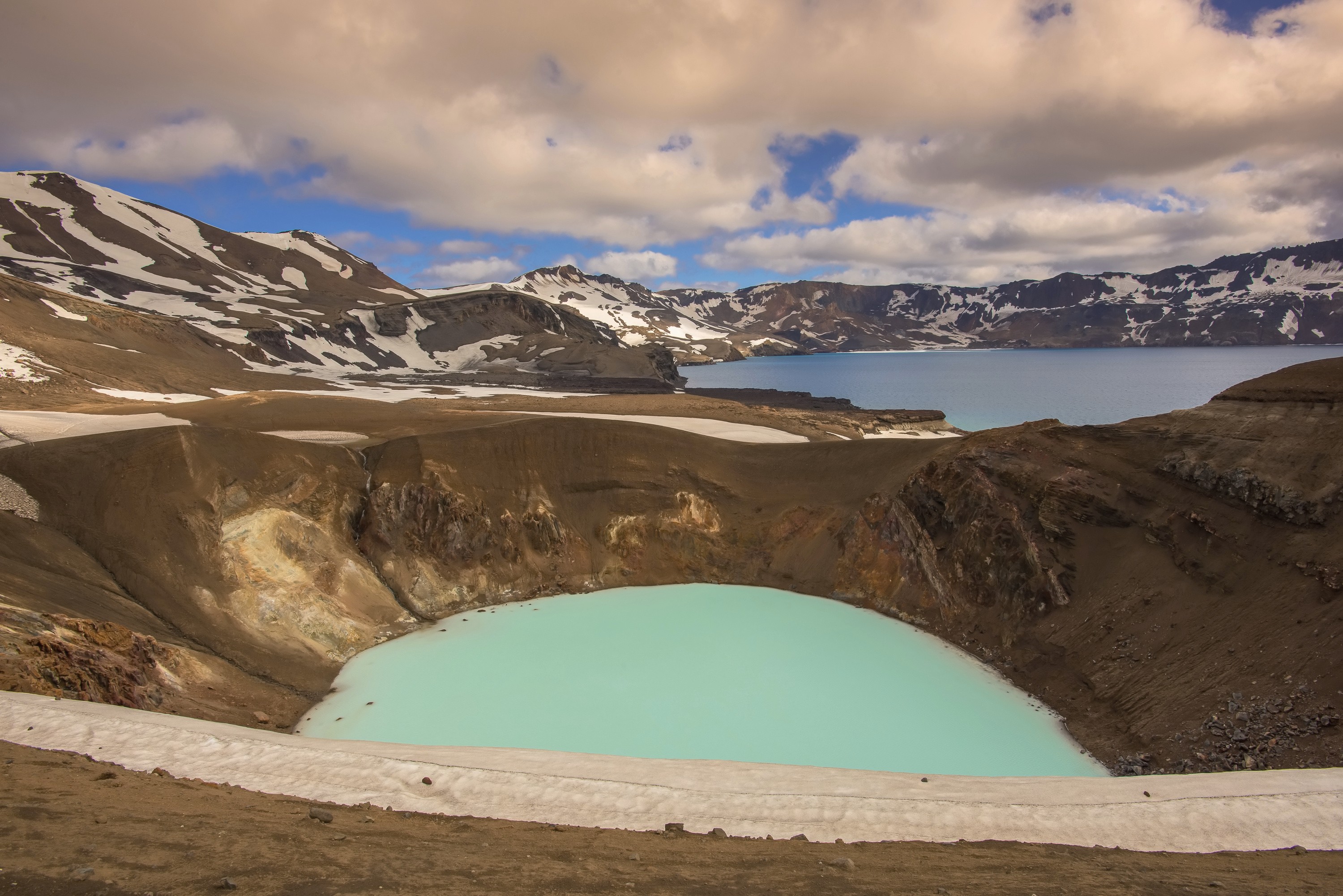
Bárðarbunga, which is classified as a subglacial stratovolcano, rises to 6,591 feet, making it the country’s second-highest peak after Hvannadalshnjúkur. It belongs to the Bárðarbunga–Veiðivötn system, which stretches for more than 118 miles across the vast Icelandic landscape. At its core lies a massive caldera measuring about 27 square miles and plunging to depths of nearly 2,789 feet.
Bárðarbunga is capable of both effusive eruptions, producing expansive lava flows, and explosive eruptions that generate ash and tephra. Geologically, it sits at the boundary where the Eurasian and North American tectonic plates meet, directly above a hotspot beneath the Vatnajökull glacier, which fuels its remarkable activity.
A History of Powerful Eruptions
Bárðarbunga has a long history of eruptions that have reshaped Iceland’s landscapes over millennia. Around 6600 BC, it produced the Þjórsá Lava, the largest Holocene lava flow on Earth, which covered 950 square kilometers. In 877 AD, shortly after Iceland’s settlement, the Vatnaöldur eruption occurred with a Volcanic Explosivity Index (VEI) of 4. Perhaps the most significant event came in 1477, when the Veiðivötn eruption, Iceland’s largest known, reached a VEI of 6.
Between 1701 and 1864, Bárðarbunga experienced a series of smaller eruptions beneath the glacier and nearby fissures, marking a particularly active period. A major eruption followed in 1910 at the Loki-Fögrufjöll area, and in 1996 the Gjálp fissure eruption suggested possible connections between Bárðarbunga and the nearby Grímsvötn volcano. Even in more recent times, Bárðarbunga has shown signs of unrest. In 2010, an earthquake swarm of more than 30 quakes, some reaching a magnitude of 3.7, reminded scientists of the volcano’s ongoing activity.
The 2014–2015 Eruption
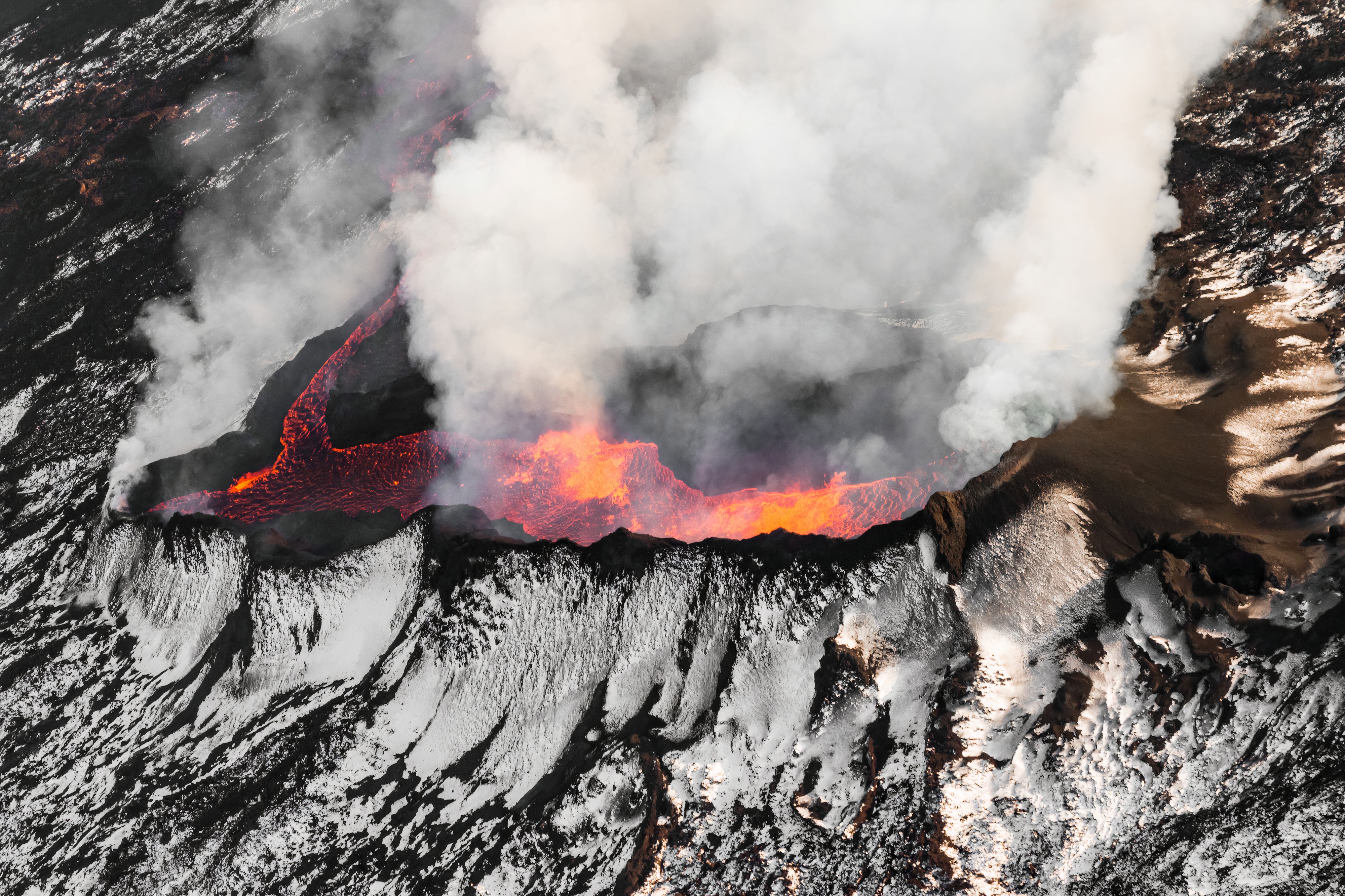
Bárðarbunga’s most recent eruption, which lasted from August 2014 to February 2015, was one of Iceland’s most remarkable modern volcanic events. The eruption occurred at the Holuhraun fissure, located just north of the main caldera, and produced approximately 0.4 cubic miles of lava. This created a new lava field covering 33 square miles, the largest in Iceland since the catastrophic Laki eruption of 1783–1784.
The event was accompanied by extraordinary seismic activity, with more than 30,000 earthquakes recorded. It also released vast amounts of sulphur dioxide into the atmosphere, lowering air quality across Iceland and reaching as far as mainland Europe. During the eruption, the Bárðarbunga caldera collapsed by up to 213 feet, a sign of the immense magma movement taking place beneath the glacier.
The Impact of Bárðarbunga’s Eruptions
The consequences of Bárðarbunga’s eruptions extend well beyond the immediate lava and ash. Explosive eruptions, such as the one in 1477, spread tephra across vast regions, blanketing the landscape and altering ecosystems. Subglacial eruptions carry the added risk of jökulhlaups, sudden glacial outburst floods that reshape valleys, move massive amounts of sediment, and change the downstream terrain. The gases released can also pose significant challenges. During large eruptions, these emissions not only affect air quality in Iceland but can also drift across borders, influencing conditions in other parts of Europe.
Signs an Eruption May Be Coming
Before Bárðarbunga erupts, it usually shows a range of warning signs. Swarms of earthquakes are one of the most common indicators, caused by magma forcing its way through the Earth’s crust. Scientists also track changes in the shape of the land, as the ground can rise or sink when magma builds below the surface. In a subglacial setting, unusual melting or shifting of the surface ice may also signal rising heat. Increased emissions of gases such as sulphur dioxide provide another clue that magma is nearing the surface. By piecing together these signs, volcanologists can often forecast when Bárðarbunga is becoming restless.
Is It Dangerous to Visit Iceland During a Volcanic Eruption?
Despite the dramatic nature of Iceland’s eruptions, the country remains remarkably safe for visitors. Bárðarbunga, for example, is located far beneath the Vatnajökull glacier, far from towns and villages. When eruptions occur near settlements, as in the recent eruptions on the Reykjanes Peninsula, Icelandic authorities act quickly by closing access to unsafe areas and issuing gas warnings.
Travelers in Iceland during an eruption are not in danger as long as they follow official guidance. While ash and sulphur dioxide can sometimes affect air quality, Iceland’s civil protection system and real-time updates from the Icelandic Meteorological Office ensure that risks are communicated clearly and that travel remains safe in most regions.
How Scientists Monitor Volcanoes
A network of surveillance systems constantly monitors Bárðarbunga and other volcanoes in Iceland. Sensitive seismographs detect earthquakes deep underground, giving early clues of magma movement. GPS instruments track subtle shifts in the Earth’s surface, while satellites provide detailed images of both the glacier and the land beneath it. Scientists also measure gas emissions, especially sulphur dioxide, to see whether magma is rising. Additionally, scientists closely monitor Vatnajökull, as sudden melting or floods can indicate hidden eruptions.
Together, these tools enable Icelandic scientists to track Bárðarbunga’s behavior in real-time, providing crucial warnings before eruptions escalate.
Bárðarbunga Compared to Other Volcanoes
To understand Bárðarbunga’s power, it helps to compare it with other well-known volcanoes:
Mauna Loa (Hawaii): Both produce extensive lava flows, but Bárðarbunga’s setting beneath ice creates additional flood hazards.
Mount Pinatubo (Philippines): Pinatubo’s explosive eruption (1991) was different in style, yet both had far-reaching atmospheric impacts.
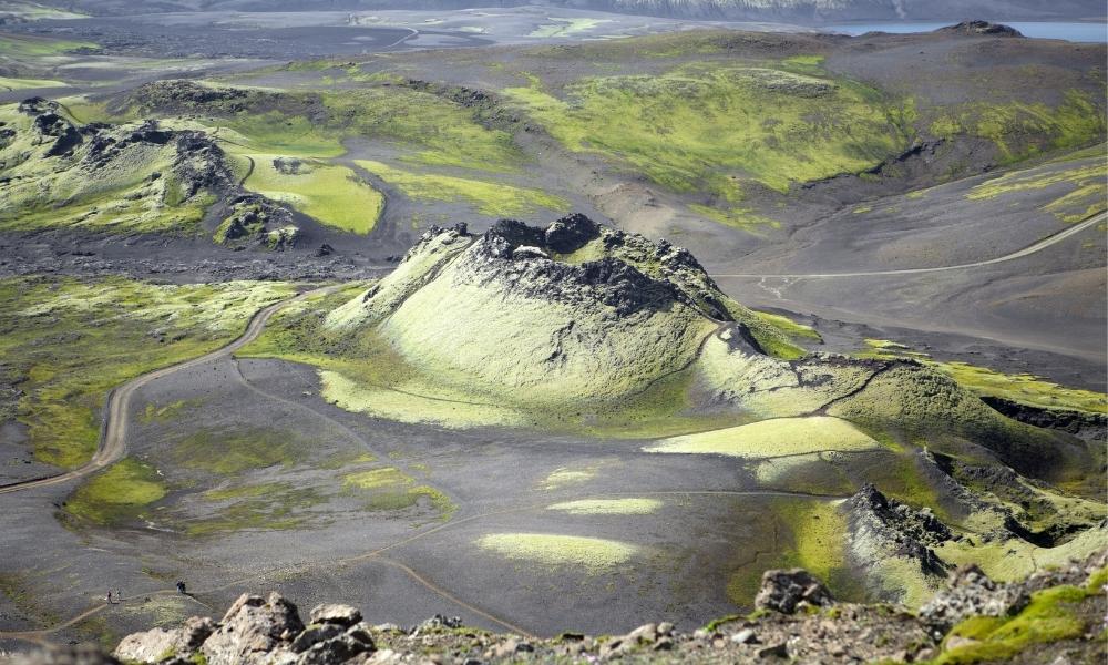
Laki (Iceland): Like Bárðarbunga, Laki’s eruptions released massive amounts of lava and gas, altering climate and ecosystems.
Mount St. Helens (USA): St. Helens’ 1980 eruption (VEI 5) was devastating, but Bárðarbunga’s 1477 eruption reached VEI 6, making it even more powerful.
A Volcano Under Watch
Today, Bárðarbunga remains closely monitored by Icelandic scientists. Its remote location under Vatnajökull means it poses limited direct risk to towns, but its scale and history make it one of the most important volcanoes in the country.
With past eruptions ranking among the largest in human history, Bárðarbunga serves as a reminder of Iceland’s dynamic geology and why the country remains a focal point for volcanology worldwide.
Frequently Asked Questions About Bárðarbunga Volcano
Experience Real Molten Lava
The Bárðarbunga eruption was one of the most extraordinary volcanic events in Iceland’s history, producing vast lava fields and reminding the world of the immense power hidden beneath the island. While witnessing an eruption like Bárðarbunga is incredibly rare, Lava Show lets you safely experience real molten lava flowing just metres away. It’s a unique opportunity to see, hear and feel the volcanic forces that continue to shape Iceland.
Plan your visit:
Experience Lava Show Reykjavík – Watch real molten lava flow in Iceland’s capital.
Experience Lava Show Vík – Experience the world’s only live lava show on Iceland’s South Coast.